


CorrectAltitude app for iPhone and iPad
Developer: SCSIproShop
First release : 31 Jan 2013
App size: 3.41 Mb
Correct Altitude establishes your position using data from at least twelve GPS satellites.
This app shows the altitude at your current location, and enables you to take altitude-and-date-stamped photographs.
Hikers usually turn off their iPhones on mountain trails because of the poor signal.
When turned on, the iPhone GPS will try to determine the current location with data from three GPS satellites; however, these co-ordinates are still inaccurate.
CorrectAltitude triangulates position with a large number of GPS satellites in a 5-minute period enabling an accurate determination of altitude.
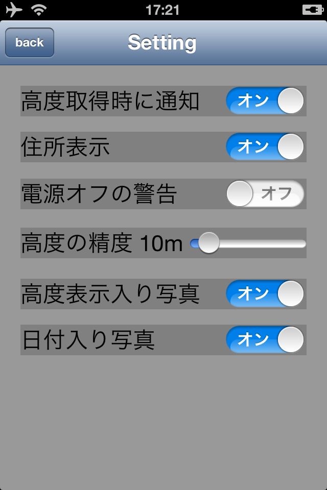
The app automatically continues triangulating position by polling GPS satellites, and informs you when it has established a location accurate to within the tolerated range of error.
The default for this range is 5 meters (approximately 16 feet).
As an add-on function, it can display where you are (if the place has a name), and this can be useful for contacting rescue services in emergencies.
CorrectAltitude has been tested on hiking trails in the Himalayas!
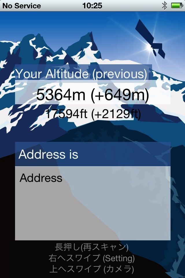
Here is an example of an altitude-and-date-stamped photograph.
The photograph is taken at the maximum resolution of your phones camera and stored.
GPS information is discarded.
If the Notify mode remains set to "ON", you will continue to get updates on altitude every five minutes.
To conserve the battery and stop repeated updates, you may prefer to set Notify mode to "OFF" after you have determined your altitude.